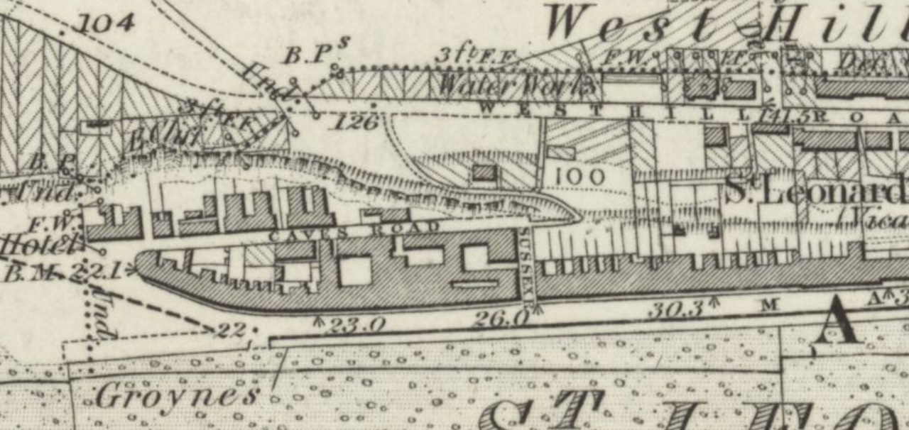
File:Area in Which St Leonards Caves were 1873.png
From Historical Hastings

Size of this preview: 1,280 × 606 pixels. Other resolutions: 320 × 151 pixels | 1,940 × 918 pixels.
Original file (1,940 × 918 pixels, file size: 1.92 MB, MIME type: image/png)
1873 mapping from https://maps.nls.uk/ showing area of St. Leonards Caves.
File history
Click on a date/time to view the file as it appeared at that time.
| Date/Time | Thumbnail | Dimensions | User | Comment | |
|---|---|---|---|---|---|
| current | 17:44, 17 October 2025 | | 1,940 × 918 (1.92 MB) | RoyPenfold (talk | contribs) |
You cannot overwrite this file.
File usage
The following page links to this file: