File:1908 Mapping overlaid on current aerial imagery of East Hill.png
From Historical Hastings

Size of this preview: 1,280 × 586 pixels. Other resolutions: 320 × 147 pixels | 640 × 293 pixels | 800 × 366 pixels | 1,347 × 617 pixels.
Original file (1,347 × 617 pixels, file size: 1.19 MB, MIME type: image/png)
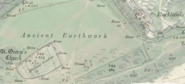
Mapping showing location of Rocklands House in relation to current aerial imagery.
File history
Click on a date/time to view the file as it appeared at that time.
| Date/Time | Thumbnail | Dimensions | User | Comment | |
|---|---|---|---|---|---|
| current | 12:40, 12 June 2022 | | 1,347 × 617 (1.19 MB) | RoyPenfold (talk | contribs) |
You cannot overwrite this file.
File usage
There are no pages that use this file.